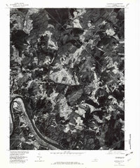
1979 Map of Scottsburg
USGS Topo · Published 1982About this map
James River curves through the southern reaches of this landscape, defining the topography of the region as recorded in 1979. This orthophotoquad, produced in cooperation with the Soil Conservation Service, offers a detailed visual record of the land use patterns during the late seventies. The settlement of Scottsville sits near the river's bend, while the upland areas feature smaller communities such as Antioch and Nicholas. The terrain is deeply carved by drainage systems including Hardware and Briery Creek, which navigate the wooded hills and cleared fields. The contrast between dense forest cover and agricultural clearings provides a clear look at the rural Virginia environment before modern development altered these traditional property lines and rural corridors.
Find a feature on this map
8 named features on this map. Tap any name to fly to it.
Don’t see what you’re looking for? This feature index may not catch every label — zoom into the map to look around manually.
Map Details
Editions of this 1979 Scottsburg Map
This is the sole edition of this map. No revisions or reprints were ever made.
Other maps of this area

1941 · Clarksville
USGS Topo · 1:48,000

1943 · Clarksville
USGS Topo · 1:62,500

1953 · South Boston
USGS Topo · 1:62,500

1953 · Greensboro
USGS Topo · 1:250,000

1954 · Greensboro
USGS Topo · 1:250,000

1954 · Clover
USGS Topo · 1:62,500

1954 · Halifax
USGS Topo · 1:62,500

1957 · South Boston
USGS Topo · 1:62,500

1957 · Clarksville
USGS Topo · 1:62,500

1962 · Greensboro
USGS Topo · 1:250,000