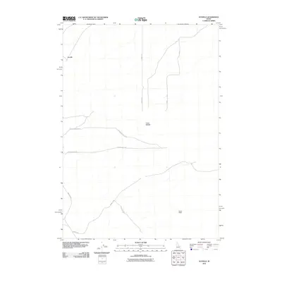
2010 Map of Scoville
USGS Topo · Published 2010About this map
The settlement of Scoville anchors this portion of Bingham County, sitting within an open landscape defined by prominent volcanic features and a network of arterial desert roads. The topography is dominated by Cerro Grande and Cedar Butte, natural landmarks that rise above the surrounding terrain in this part of southeastern Idaho. This 2010 survey illustrates the developed transportation grid essential for reaching these points of interest, including the convergence of Big Southern Butte Rd and Cedar Big Butte Rd. The map also captures the paths of Number 8 Rd and T-16 Rd, which provide access to the area's interior. Further south, the routes of Frenchglen Rd and Cedar Butte Rd demonstrate how infrastructure integrates with the natural landmarks like Big Butte Rd.
Find a feature on this map
10 named features on this map. Tap any name to fly to it.
Don’t see what you’re looking for? This feature index may not catch every label — zoom into the map to look around manually.
Map Details
Editions of this 2010 Scoville Map
This is the sole edition of this map. No revisions or reprints were ever made.
Other maps of this area

1955 · Idaho Falls
USGS Topo · 1:250,000

1958 · Idaho Falls
USGS Topo · 1:250,000

1972 · Arco Hills SE
USGS Topo · 1:24,000

1972 · Big Southern Butte
USGS Topo · 1:24,000

1972 · Sunset Lake
USGS Topo · 1:24,000

1973 · Scoville
USGS Topo · 1:24,000

1973 · Rock Butte
USGS Topo · 1:24,000

1973 · Atomic City
USGS Topo · 1:24,000

1973 · Lava Lake Reservoir
USGS Topo · 1:24,000

1973 · Circular Butte 3 SW
USGS Topo · 1:24,000