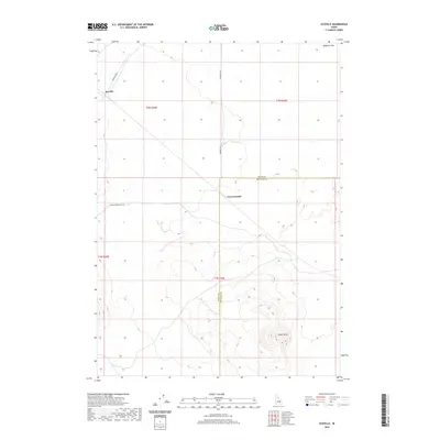
2020 Map of Scoville
USGS Topo · Published 2020About this map
Scoville occupies the northwestern corner of this High Desert landscape, situated along Farragut Blvd. The area is defined by stark volcanic terrain, featuring the prominent elevation of Cedar Butte in the southeast and the lower rise of Cerro Grande near the center. The Butte Co Bingham Co boundary bisects the quadrangle, marking a jurisdictional line across the arid plains of Ryegrass Flat. Transportation through this isolated region is maintained by a network of functional routes, including Number 8 Rd and Big Southern Butte Rd. This survey captures the intersection of public land management and geographic isolation, documenting a space where named landmarks are sparse and significant, serving as vital navigation points in the expansive Idaho sagebrush and basalt environment.
Find a feature on this map
12 named features on this map. Tap any name to fly to it.
Don’t see what you’re looking for? This feature index may not catch every label — zoom into the map to look around manually.
Map Details
Editions of this 2020 Scoville Map
This is the sole edition of this map. No revisions or reprints were ever made.
Other maps of this area

1955 · Idaho Falls
USGS Topo · 1:250,000

1958 · Idaho Falls
USGS Topo · 1:250,000

1972 · Arco Hills SE
USGS Topo · 1:24,000

1972 · Big Southern Butte
USGS Topo · 1:24,000

1972 · Sunset Lake
USGS Topo · 1:24,000

1973 · Scoville
USGS Topo · 1:24,000

1973 · Rock Butte
USGS Topo · 1:24,000

1973 · Atomic City
USGS Topo · 1:24,000

1973 · Lava Lake Reservoir
USGS Topo · 1:24,000

1973 · Circular Butte 3 SW
USGS Topo · 1:24,000