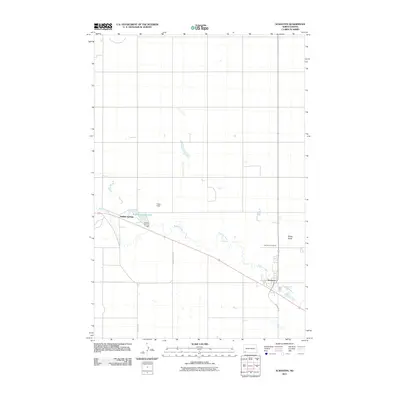
2011 Map of Scranton
USGS Topo · Published 2011About this map
Scranton serves as the primary hub for this portion of Bowman County, positioned along the meandering path of Buffalo Creek. The settlement is closely tied to the agricultural and prairie landscape, with Scranton Cemetery located just north of the residential center. Further west, Buffalo Springs and Fisher Field illustrate the sparse but deliberate distribution of communities across the high plains. The landscape is defined by its water management and distinct terrain features, notably the Buffalo Springs Lake created by the Buffalo Springs Dam. In the northeast, Moga Butte rises above the surrounding flats, while the South Fork Cedar Creek drains the northern reaches of the quadrangle. Local transportation is facilitated by thoroughfares such as Scranton Rd and Circle K Rd, which connect these isolated homesteads and settlements across the vast North Dakota horizon.
Find a feature on this map
11 named features on this map. Tap any name to fly to it.
Don’t see what you’re looking for? This feature index may not catch every label — zoom into the map to look around manually.
Map Details
Editions of this 2011 Scranton Map
This is the sole edition of this map. No revisions or reprints were ever made.
Other maps of this area

1953 · Dickinson
USGS Topo · 1:250,000

1957 · Dickinson
USGS Topo · 1:250,000

1969 · Scranton
USGS Topo · 1:24,000

1969 · Gascoyne
USGS Topo · 1:24,000

1969 · Scranton NE
USGS Topo · 1:24,000

1973 · Warnke Hill
USGS Topo · 1:24,000

1973 · Mineral Springs
USGS Topo · 1:24,000

1973 · Talbot Butte
USGS Topo · 1:24,000

1973 · Amidon SE
USGS Topo · 1:24,000
1973 · Scranton SW
USGS Topo · 1:24,000