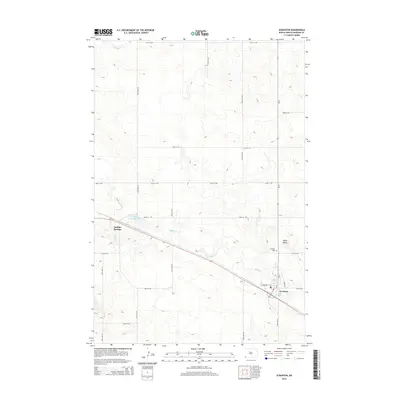
2014 Map of Scranton
USGS Topo · Published 2014About this map
Scranton serves as the primary hub in this corner of Bowman County, situated along the southern bend of Buffalo Cr. The township grid is well-defined by local routes such as Hamilton St SW and 88th St SW, which connect the residential and industrial areas of the town to the surrounding agricultural landscape. To the west, the settlement of Buffalo Springs sits near the banks of Buffalo Springs Lake, marking another point of human activity along the Us-12 corridor. The terrain is punctuated by the prominent Moga Butte to the east, rising above the prairie flats. Genealogists will note the location of the Scranton Cem just north of the town center, while hydrological features like S Fork Cedar Cr in the northwest corner illustrate the natural drainage patterns of this high plains region.
Find a feature on this map
24 named features on this map. Tap any name to fly to it.
Don’t see what you’re looking for? This feature index may not catch every label — zoom into the map to look around manually.
Map Details
Editions of this 2014 Scranton Map
This is the sole edition of this map. No revisions or reprints were ever made.
Other maps of this area

1953 · Dickinson
USGS Topo · 1:250,000

1957 · Dickinson
USGS Topo · 1:250,000

1969 · Scranton
USGS Topo · 1:24,000

1969 · Gascoyne
USGS Topo · 1:24,000

1969 · Scranton NE
USGS Topo · 1:24,000

1973 · Warnke Hill
USGS Topo · 1:24,000

1973 · Mineral Springs
USGS Topo · 1:24,000

1973 · Talbot Butte
USGS Topo · 1:24,000

1973 · Amidon SE
USGS Topo · 1:24,000
1973 · Scranton SW
USGS Topo · 1:24,000