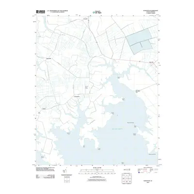
2010 Map of Scranton
USGS Topo · Published 2010About this map
Germantown and Scranton anchor this coastal landscape in Hyde County, where the terrestrial world meets the complex inlets of the Atlantic Ocean. The geography is defined by a deep network of peninsulas and points, including Watch Point, Ranger Point, and Spencer Point, which frame the low-lying shoreline. This area of the Inner Banks shows a pattern of agricultural drainage and rural roads such as Puddin Hill Rd and Lynnsburg Rd that serve isolated farmsteads and small settlements like Sladesville.
Find a feature on this map
33 named features on this map. Tap any name to fly to it.
Don’t see what you’re looking for? This feature index may not catch every label — zoom into the map to look around manually.
Map Details
Editions of this 2010 Scranton Map
This is the sole edition of this map. No revisions or reprints were ever made.
Other maps of this area

1914 · Belhaven
USGS Topo · 1:48,000

1916 · Belhaven
USGS Topo · 1:62,500

1943 · Columbia
USGS Topo · 1:125,000

1943 · Plymouth
USGS Topo · 1:125,000

1950 · Lowland
USGS Topo · 1:24,000

1951 · Pamlico Point
USGS Topo · 1:24,000

1951 · Great Island
USGS Topo · 1:24,000

1951 · Pamlico Beach
USGS Topo · 1:24,000

1951 · Belhaven
USGS Topo · 1:24,000

1951 · Scranton
USGS Topo · 1:24,000