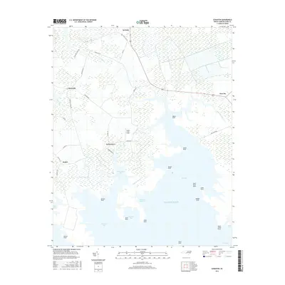
2016 Map of Scranton
USGS Topo · Published 2016About this map
Germantown and the surrounding coastal reaches of Hyde County are defined by a complex interface of marshland and water along the northern reaches of the Atlantic Ocean. The settlement pattern follows established corridors like Old US Hwy 264 and Sladesville-Credle Rd, connecting small communities such as Scranton and Sladesville. The landscape is dominated by tidal inlets and points, where Germantown Bay, Rose Bay, and Spencer Bay carve into the low-lying terrain.
Find a feature on this map
45 named features on this map. Tap any name to fly to it.
Don’t see what you’re looking for? This feature index may not catch every label — zoom into the map to look around manually.
Map Details
Editions of this 2016 Scranton Map
This is the sole edition of this map. No revisions or reprints were ever made.
Other maps of this area

1914 · Belhaven
USGS Topo · 1:48,000

1916 · Belhaven
USGS Topo · 1:62,500

1943 · Columbia
USGS Topo · 1:125,000

1943 · Plymouth
USGS Topo · 1:125,000

1950 · Lowland
USGS Topo · 1:24,000

1951 · Pamlico Point
USGS Topo · 1:24,000

1951 · Great Island
USGS Topo · 1:24,000

1951 · Pamlico Beach
USGS Topo · 1:24,000

1951 · Belhaven
USGS Topo · 1:24,000

1951 · Scranton
USGS Topo · 1:24,000