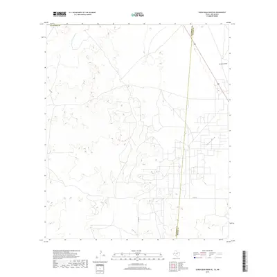
2019 Map of Screw Bean Draw NE
USGS Topo · Published 2019About this map
Delaware River flows across the northern reaches of this arid landscape where the boundary between Culberson and Reeves counties is clearly defined. The terrain is marked by a complex system of seasonal watercourses, including the notable China Draw, Hackberry Draw, and Gyp Draw, which trace the drainage patterns of the Trans-Pecos region. Transportation across this sparsely populated section of West Texas is anchored by Highway 285, which runs diagonally toward the northeast, and local routes like Carlsbad Rd and Co Rd 449. The map provides a detailed look at the topographic relief and survey boundaries in a region defined by its vast drainage basins and ranching infrastructure.
Find a feature on this map
9 named features on this map. Tap any name to fly to it.
Don’t see what you’re looking for? This feature index may not catch every label — zoom into the map to look around manually.
Map Details
Editions of this 2019 Screw Bean Draw NE Map
This is the sole edition of this map. No revisions or reprints were ever made.
Other maps of this area

1925 · Orla 2-b
USGS Topo · 1:48,000

1931 · Orla
USGS Topo · 1:62,500

1945 · Malaga
USGS Topo · 1:62,500

1946 · Malaga
USGS Topo · 1:62,500

1954 · Carlsbad
USGS Topo · 1:250,000

1954 · Hobbs
USGS Topo · 1:250,000

1954 · Van Horn
USGS Topo · 1:250,000

1954 · Pecos
USGS Topo · 1:250,000

1957 · Pecos
USGS Topo · 1:250,000

1958 · Van Horn
USGS Topo · 1:250,000