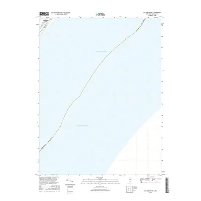
2016 Map of Sea Isle City OE E
USGS Topo · Published 2016About this map
Ocean City occupies the northwest corner of this coastal survey, where the grid of a seaside community meets the vast expanse of the Atlantic Ocean. The map documents a small segment of the southern portion of the barrier island, showing the residential and commercial layout defined by Bay Ave, Asbury Ave, and Central Ave. These thoroughfares, intersected by 56th St, represent the primary footprint of human development in an area otherwise dominated by open water.
Find a feature on this map
9 named features on this map. Tap any name to fly to it.
Don’t see what you’re looking for? This feature index may not catch every label — zoom into the map to look around manually.
Map Details
Editions of this 2016 Sea Isle City OE E Map
This is the sole edition of this map. No revisions or reprints were ever made.
Other maps of this area

1884 · Sea Isle
USGS Topo · 1:62,500

1887 · Atlantic City
USGS Topo · 1:62,500

1888 · Sea Isle
USGS Topo · 1:62,500

1890 · Great Egg Harbor
USGS Topo · 1:62,500

1893 · Great Egg Harbor
USGS Topo · 1:62,500

1894 · Sea Isle
USGS Topo · 1:62,500

1894 · Atlantic City
USGS Topo · 1:62,500

1918 · Great Egg Harbor
USGS Topo · 1:62,500

1919 · Sea Isle
USGS Topo · 1:62,500

1940 · Atlantic City
USGS Topo · 1:62,500