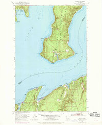
1953 Map of Seabeck
USGS Topo · Published 1969About this map
The maritime landscape of Hood Canal and Dabob Bay dominates this mid-century topographical study, centered on the historic mill town of Seabeck. The geography is defined by the reaching fingers of the Toandos Peninsula, where the small settlement of Coyle sits near Fisherman Harbor. Along the southern shoreline, residential and recreational growth is evident in beach developments like Miami Beach and Scenic Beach, alongside the established Conference Grounds.
Find a feature on this map
37 named features on this map. Tap any name to fly to it.
Don’t see what you’re looking for? This feature index may not catch every label — zoom into the map to look around manually.
Map Details
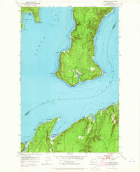
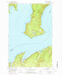
Editions of this 1953 Seabeck Map
4 editions found
Other maps of this area

1936 · Point Misery
USGS Topo · 1:62,500

1937 · Port Orchard
USGS Topo · 1:62,500

1937 · Port Gamble
USGS Topo · 1:62,500

1940 · Port Gamble
USGS Topo · 1:62,500

1940 · Point Misery
USGS Topo · 1:62,500

1940 · Quilcene
USGS Topo · 1:62,500

1953 · Seabeck
USGS Topo · 1:24,000

1953 · Poulsbo
USGS Topo · 1:24,000

1953 · Quilcene
USGS Topo · 1:24,000

1953 · Mt. Walker
USGS Topo · 1:24,000