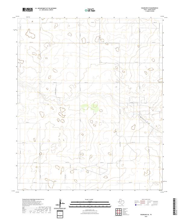
2022 Map of Seagraves SE
USGS Topo · Published 2022About this map
McKenzie Draw meanders through this portion of Gaines County, providing a natural drainage corridor across the High Plains landscape. The map reveals a strictly organized grid of rural infrastructure, with numerous county roads such as Co Rd 122, Co Rd 109, and Co Rd 108 defining the agricultural and ranching boundaries of the region. A more personal layer of local history is visible in the naming of Mamaw & Papaw's Rd, reflecting the individual family legacies that persist alongside state-maintained routes like Ranch Rd 1429. The terrain is characterized by subtle depressions and the broad reach of the draw, illustrating the specific hydrological patterns of West Texas where water flow is infrequent but geologically significant.
Find a feature on this map
22 named features on this map. Tap any name to fly to it.
Don’t see what you’re looking for? This feature index may not catch every label — zoom into the map to look around manually.
Map Details
Editions of this 2022 Seagraves SE Map
This is the sole edition of this map. No revisions or reprints were ever made.
Other maps of this area

1954 · Hobbs
USGS Topo · 1:250,000

1958 · Hobbs
USGS Topo · 1:250,000

1969 · Loop
USGS Topo · 1:24,000

1970 · Seagraves SW
USGS Topo · 1:24,000

1970 · Seminole NE
USGS Topo · 1:24,000

1970 · Seagraves SE
USGS Topo · 1:24,000

1970 · McKenzie Lake NW
USGS Topo · 1:24,000

1970 · Seagraves
USGS Topo · 1:24,000
1970 · Loop SW
USGS Topo · 1:24,000

1970 · Seagraves NW
USGS Topo · 1:24,000