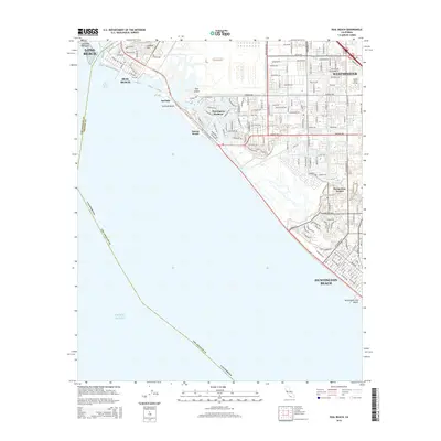
2015 Map of Seal Beach
USGS Topo · Published 2015About this map
The Alamitos Peninsula and the coastal corridor of the Orange-Los Angeles county line define this mid-2010s survey. The map details the dense suburban and aquatic development of Huntington Harbour, where a complex network of channels and streets like Davenport Dr and Humboldt Dr create a unique residential-maritime landscape. Inland, the established neighborhoods of Westminster and Ocean View Estates show the maturity of the region's mid-century expansion, while Golden West College serves as a central institutional landmark. The transition from the sandy reaches of Surfside Beach and Sunset Beach to the tidal environments of Bolsa Bay illustrates the varied nature of the Southern California coast. Water management is a prominent theme, visible through the Bolsa Chica Channel and Westminster Channel which cut through the grid of the coastal plain.
Find a feature on this map
155 named features on this map. Tap any name to fly to it.
Don’t see what you’re looking for? This feature index may not catch every label — zoom into the map to look around manually.
Map Details
Editions of this 2015 Seal Beach Map
This is the sole edition of this map. No revisions or reprints were ever made.
Other maps of this area

1896 · Santa Ana
USGS Topo · 1:62,500

1896 · Anaheim
USGS Topo · 1:62,500

1896 · Las Bolsas
USGS Topo · 1:62,500

1896 · Downey
USGS Topo · 1:62,500

1898 · Anaheim
USGS Topo · 1:62,500

1899 · Downey
USGS Topo · 1:62,500

1901 · Southern California Sheet No. 1
USGS Topo · 1:250,000

1901 · Santa Ana
USGS Topo · 1:62,500

1901 · Anaheim
USGS Topo · 1:62,500

1902 · Downey
USGS Topo · 1:62,500