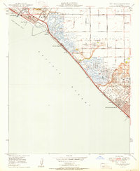
1950 Map of Seal Beach
USGS Topo · Published 1950About this map
Pacific Electric railway lines cut a diagonal path across this coastal landscape just after the war, connecting the beach communities of Seal Beach and Sunset Beach to the interior. The shoreline is defined by extensive wetlands and tidal marshes, including Anaheim Bay and Bolsa Bay, which remained largely undeveloped for recreation during this era. Instead, the area supported specialized land uses like the Naval Reservation and numerous private sporting organizations such as the Cazzadores Gun Club and Lomita Gun Club.
Find a feature on this map
45 named features on this map. Tap any name to fly to it.
Don’t see what you’re looking for? This feature index may not catch every label — zoom into the map to look around manually.
Map Details
Editions of this 1950 Seal Beach Map
This is the sole edition of this map. No revisions or reprints were ever made.
Other maps of this area

1896 · Santa Ana
USGS Topo · 1:62,500

1896 · Anaheim
USGS Topo · 1:62,500

1896 · Las Bolsas
USGS Topo · 1:62,500

1896 · Downey
USGS Topo · 1:62,500

1898 · Anaheim
USGS Topo · 1:62,500

1899 · Downey
USGS Topo · 1:62,500

1901 · Southern California Sheet No. 1
USGS Topo · 1:250,000

1901 · Santa Ana
USGS Topo · 1:62,500

1901 · Anaheim
USGS Topo · 1:62,500

1902 · Downey
USGS Topo · 1:62,500