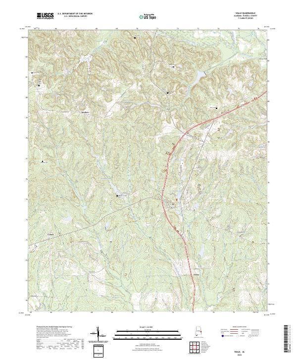
2024 Map of Seale
USGS Topo · Published 2024About this map
Uchee Creek and its many tributaries, including Watermelon Creek and Weolustee Creek, define the drainage patterns of this Russell County landscape. The settlement of Sandfort sits at a central crossroads, while Colbert and Villula anchor the western and southeastern reaches. The geography is marked by numerous family and community burial grounds, such as Williams Dudley Cem, Boykin Cem, and Bass Cem, which offer significant touchpoints for genealogical research in the region.
Find a feature on this map
71 named features on this map. Tap any name to fly to it.
Don’t see what you’re looking for? This feature index may not catch every label — zoom into the map to look around manually.
Map Details
Editions of this 2024 Seale Map
This is the sole edition of this map. No revisions or reprints were ever made.
Other maps of this area

1914 · Seale
USGS Topo · 1:62,500

1949 · Fort Mitchell
USGS Topo · 1:24,000

1950 · Crawford
USGS Topo · 1:24,000

1950 · Seale
USGS Topo · 1:24,000

1950 · Phenix City
USGS Topo · 1:24,000

1950 · Seale
USGS Topo · 1:62,500

1955 · Phenix City
USGS Topo · 1:24,000

1955 · Seale
USGS Topo · 1:24,000

1955 · Crawford
USGS Topo · 1:24,000
1955 · Fort Mitchell
USGS Topo · 1:24,000