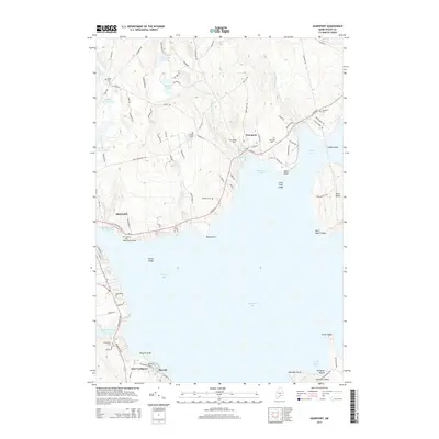
2014 Map of Searsport
USGS Topo · Published 2014About this map
The coastal village of Searsport anchors this mid-coast Maine survey, where the seafaring history of Penobscot Bay meets the modern infrastructure of Mack Point. The landscape is defined by the deep indentation of Long Cove and the prominent Sears Island, which remains a significant undeveloped landmass in the harbor. Moving inland, the terrain is dotted with numerous small family and community burial grounds, including Smart Cem, Mt Hope Cem, and Bowditch Cem, providing a detailed map for genealogists. Water resources are plentiful, with the Goose River flowing toward Belfast Bay and several distinct bodies of water like Upper Mason Pond and McClure Pond situated among the winding coastal roads. To the south, the village of Bayside and the peninsula of Turtle Head on Islesboro Island mark the transition into the deeper waters of the bay, illustrating the intricate shoreline of Waldo County.
Find a feature on this map
102 named features on this map. Tap any name to fly to it.
Don’t see what you’re looking for? This feature index may not catch every label — zoom into the map to look around manually.
Map Details
Editions of this 2014 Searsport Map
This is the sole edition of this map. No revisions or reprints were ever made.
Other maps of this area

1900 · Bucksport
USGS Topo · 1:62,500

1902 · Bucksport
USGS Topo · 1:62,500

1902 · Castine
USGS Topo · 1:62,500

1904 · Castine
USGS Topo · 1:62,500

1905 · Penobscot Bay
USGS Topo · 1:125,000

1915 · Belfast
USGS Topo · 1:62,500

1917 · Belfast
USGS Topo · 1:62,500

1932 · Brooks
USGS Topo · 1:62,500

1941 · Belfast
USGS Topo · 1:62,500

1941 · Castine
USGS Topo · 1:62,500