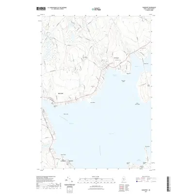
2021 Map of Searsport
USGS Topo · Published 2021About this map
Searsport Harbor and the deep waters of Penobscot Bay anchor this coastal Maine landscape, where the maritime tradition is evidenced by the prominent industrial infrastructure at Mack Point and the adjacent Kidder Point. The terrain is defined by a series of north-south drainages including Mill Brook and Piper Brook, which feed into the Mill Pond at the heart of Searsport. To the south, the village of Bayside and East Northport sit along the western shore of the bay, while the large, undeveloped mass of Sears Island remains a significant coastal feature.
Find a feature on this map
96 named features on this map. Tap any name to fly to it.
Don’t see what you’re looking for? This feature index may not catch every label — zoom into the map to look around manually.
Map Details
Editions of this 2021 Searsport Map
This is the sole edition of this map. No revisions or reprints were ever made.
Other maps of this area

1900 · Bucksport
USGS Topo · 1:62,500

1902 · Bucksport
USGS Topo · 1:62,500

1902 · Castine
USGS Topo · 1:62,500

1904 · Castine
USGS Topo · 1:62,500

1905 · Penobscot Bay
USGS Topo · 1:125,000

1915 · Belfast
USGS Topo · 1:62,500

1917 · Belfast
USGS Topo · 1:62,500

1932 · Brooks
USGS Topo · 1:62,500

1941 · Belfast
USGS Topo · 1:62,500

1941 · Castine
USGS Topo · 1:62,500