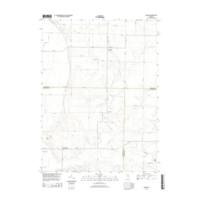
2015 Map of Seaton
USGS Topo · Published 2015About this map
Seaton and Little York anchor this agricultural landscape at the tri-county junction where Mercer, Henderson, and Warren counties meet. The terrain is defined by a dense network of waterways, including North Henderson Creek and Cedar Creek, which have carved deep drainages into the prairie. These natural corridors are contrasted by a rigid grid of rural roads like 35th Ave and 270th Ave.
Find a feature on this map
44 named features on this map. Tap any name to fly to it.
Don’t see what you’re looking for? This feature index may not catch every label — zoom into the map to look around manually.
Map Details
Editions of this 2015 Seaton Map
This is the sole edition of this map. No revisions or reprints were ever made.
Other maps of this area

1921 · Monmouth
USGS Topo · 1:62,500

1923 · Monmouth
USGS Topo · 1:62,500

1923 · Alexis
USGS Topo · 1:62,500

1925 · Alexis
USGS Topo · 1:62,500

1934 · Oquawka
USGS Topo · 1:48,000

1935 · Keithsburg
USGS Topo · 1:48,000

1940 · Oquawka
USGS Topo · 1:62,500

1941 · Keithsburg
USGS Topo · 1:62,500
1953 · Aledo East
USGS Topo · 1:24,000
1953 · Joy
USGS Topo · 1:24,000