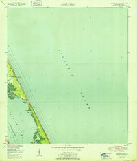
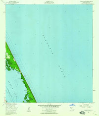
1951 Map of Sebastian NW
USGS Topo · Published 1951About this map
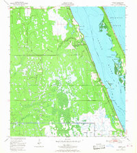
The Intracoastal Waterway and the narrow barrier islands of Florida's Atlantic coast define this 1951 coastal survey. Following the line of a1a, the map details a landscape of shifting sands and sheltered waters, where the Atlantic Ocean meets the quiet reaches of the Indian River. Small residential clusters like Evans Pines and Ballard Pines sit tucked between the dunes and the mangrove-lined shores.
Find a feature on this map
21 named features on this map. Tap any name to fly to it.
Don’t see what you’re looking for? This feature index may not catch every label — zoom into the map to look around manually.
Map Details
Editions of this 1951 Sebastian NW Map
This is the sole edition of this map. No revisions or reprints were ever made.
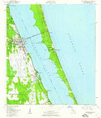
Other maps of this area

1949 · Fellsmere
USGS Topo · 1:24,000
1949 · Melbourne East
USGS Topo · 1:24,000
1949 · Sebastian NW
USGS Topo · 1:24,000
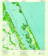
1949 · Sebastian
USGS Topo · 1:24,000
1949 · Grant
USGS Topo · 1:24,000

1951 · Melbourne East
USGS Topo · 1:24,000
1951 · Fellsmere
USGS Topo · 1:24,000

1951 · Grant
USGS Topo · 1:24,000
1951 · Sebastian
USGS Topo · 1:24,000

1955 · Orlando
USGS Topo · 1:250,000