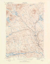
1940 Map of Sebec
USGS Topo · Published 1958About this map
The industrial and railway heritage of Piscataquis County is clearly defined in this survey, particularly where the Bangor and Aroostook and Canadian Pacific lines converge at Brownville Junction. This intersection was a critical node for the region's timber and mineral transport. Further northwest, the legacy of 19th-century industry is visible at Katahhdin Iron Works near the shores of Silver Lake, marking a site that once anchored the local economy before the shift toward recreational and timber management landscapes.
Find a feature on this map
132 named features on this map. Tap any name to fly to it.
Don’t see what you’re looking for? This feature index may not catch every label — zoom into the map to look around manually.
Map Details
Editions of this 1940 Sebec Map
4 editions found
Other maps of this area

1932 · Dover-Foxcroft
USGS Topo · 1:48,000

1933 · Boyd Lake
USGS Topo · 1:62,500

1933 · Guilford
USGS Topo · 1:62,500

1935 · Dover-Foxcroft
USGS Topo · 1:62,500

1937 · Guilford
USGS Topo · 1:62,500

1940 · Sebec
USGS Topo · 1:48,000

1943 · Sebec
USGS Topo · 1:62,500

1947 · Schoodic
USGS Topo · 1:62,500

1949 · Schoodic
USGS Topo · 1:62,500

1950 · Sebec Lake
USGS Topo · 1:62,500