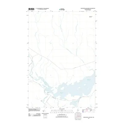
2011 Map of Seboomook Lake West
USGS Topo · Published 2011About this map
Pittston Farm and Warden Camp stand as the primary human outposts in this northern Somerset County landscape, situated at the strategic confluence of the North Branch Penobscot River and South Branch Penobscot River. These waterways feed directly into the western reaches of Seboomook Lake, a massive reservoir that dominates the southern half of the region. The map reveals a transition from the complex river channels and marshy flats near the lake to the rising elevations of Seboomook Mountain in the northeast.
Find a feature on this map
17 named features on this map. Tap any name to fly to it.
Don’t see what you’re looking for? This feature index may not catch every label — zoom into the map to look around manually.
Map Details
Editions of this 2011 Seboomook Lake West Map
This is the sole edition of this map. No revisions or reprints were ever made.
Other maps of this area

1949 · Jackman
USGS Topo · 1:250,000

1954 · Seboomook Lake
USGS Topo · 1:62,500

1954 · St. John Pond
USGS Topo · 1:62,500

1954 · Presque Isle
USGS Topo · 1:250,000

1954 · Millinocket
USGS Topo · 1:250,000

1956 · Penobscot Lake
USGS Topo · 1:62,500

1957 · Norris Brook
USGS Topo · 1:62,500

1958 · Presque Isle
USGS Topo · 1:250,000

1958 · Millinocket
USGS Topo · 1:250,000

1958 · Saint John Pond
USGS Topo · 1:62,500
Featured Places
- Pittston Academy Grant, ME
- Comstock Township, ME
- T4 R17 WELS, ME
- Plymouth Township, ME
- Somerset County, ME