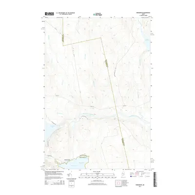
2014 Map of Seboomook
USGS Topo · Published 2014About this map
Seboomook Lake and the northern reaches of Moosehead Lake dominate this Maine landscape, where the West Branch Penobscot River flows eastward through the heart of the woods. The settlement of Seboomook serves as a focal point near the southern shoreline of its namesake lake, marking a critical junction for logging and transport routes like the Golden Rd and Seboomook Rd. The hydraulic management of the region is centered on the Seboomook Dam, which regulates the flow from the lake into the river. To the east, the terrain becomes increasingly waterlogged near Cassidy Deadwater and Russell Stream. This 2014 survey captures a timber-producing landscape defined by the crossing of the Somerset and Piscataquis county line, illustrating the complex network of private forest roads and natural drainages like Elm Stream and Carry Brook that have long supported the local wood-harvesting economy.
Find a feature on this map
20 named features on this map. Tap any name to fly to it.
Don’t see what you’re looking for? This feature index may not catch every label — zoom into the map to look around manually.
Map Details
Editions of this 2014 Seboomook Map
This is the sole edition of this map. No revisions or reprints were ever made.
Other maps of this area

1954 · Seboomook Lake
USGS Topo · 1:62,500

1954 · North East Carry
USGS Topo · 1:62,500

1954 · Caucomgomoc Lake
USGS Topo · 1:62,500

1954 · St. John Pond
USGS Topo · 1:62,500

1954 · Presque Isle
USGS Topo · 1:250,000

1954 · Millinocket
USGS Topo · 1:250,000

1958 · Presque Isle
USGS Topo · 1:250,000

1958 · Millinocket
USGS Topo · 1:250,000

1958 · Caucomgomoc Lake
USGS Topo · 1:62,500

1958 · Saint John Pond
USGS Topo · 1:62,500
Featured Places
- Northeast Carry Township, ME
- Big W Township, ME
- Elm Stream Township, ME
- T4 R15 WELS, ME
- Seboomook, Big W Township