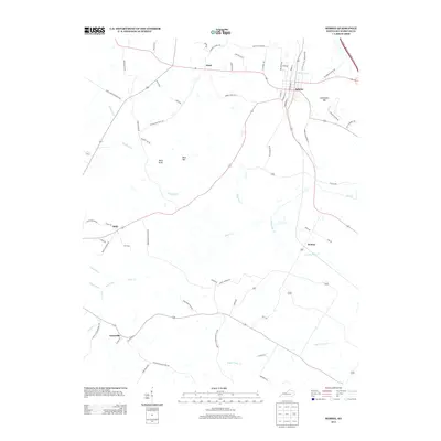
2013 Map of Sebree
USGS Topo · Published 2013About this map
The town of Sebree stands as the primary hub in this northern Webster County landscape, defined by its grid of streets such as S State St and its proximity to the Edward T. Breathitt Pennyrile Pkwy. The surrounding countryside is dotted with smaller communities including Pratt, Ortiz, and Gatesville, linked by a network of rural routes like Sebree Pratt Rd and Old Beech Grove Rd. This region is characterized by a mix of agricultural lowlands drained by systems like Melton Ditch and Jackson Ditch, and prominent rises such as Steamport Hill and Bald Knob. Local history is embedded in the family-named roads and landmarks, from Beal Hill to the winding course of Deer Creek. The map documents a modern landscape where historical settlement patterns along the creeks still influence the placement of rural homes and secondary roads.
Find a feature on this map
67 named features on this map. Tap any name to fly to it.
Don’t see what you’re looking for? This feature index may not catch every label — zoom into the map to look around manually.
Map Details
Editions of this 2013 Sebree Map
This is the sole edition of this map. No revisions or reprints were ever made.
Other maps of this area

1906 · Sebree
USGS Topo · 1:62,500

1907 · Earlington
USGS Topo · 1:48,000

1908 · Calhoun
USGS Topo · 1:62,500

1909 · Earlington
USGS Topo · 1:62,500

1909 · Madisonville
USGS Topo · 1:62,500

1949 · Sebree
USGS Topo · 1:24,000

1949 · Poole
USGS Topo · 1:24,000

1949 · Robards
USGS Topo · 1:24,000

1951 · Dixon
USGS Topo · 1:24,000

1951 · Poole
USGS Topo · 1:24,000