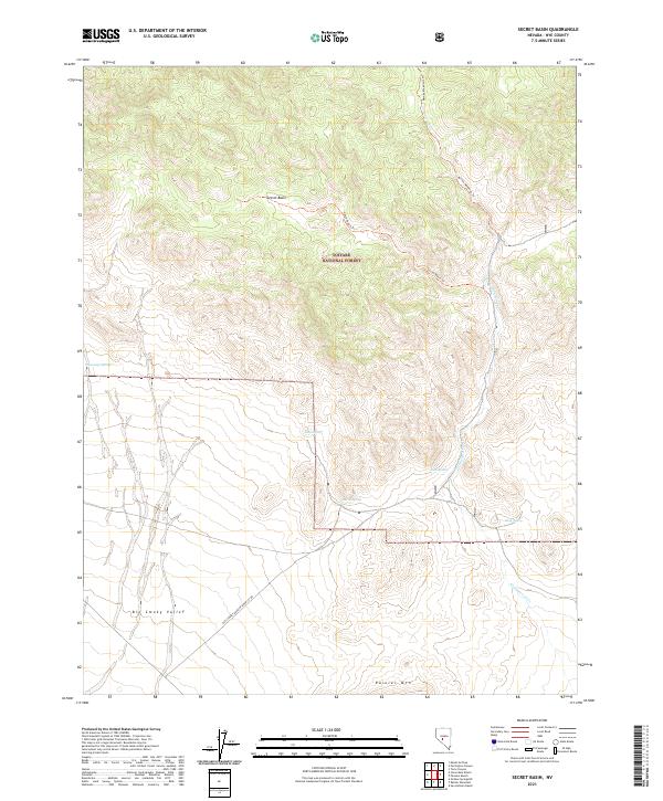
2021 Map of Secret Basin
USGS Topo · Published 2021About this map
Toiyabe National Forest encompasses the rugged high-elevation landscape of this portion of Nye County, where the northern end of Big Smoky Valley meets the slopes leading toward Rainier Mtn. The terrain is defined by a series of vital water sources in an otherwise arid environment, including Mississippi Springs, Mud Spring, and Barrel Spring. These natural features have historically dictated movement through the basin, supported by established paths like the Barney Meadows Trl and the Secret Basin Trl.
Find a feature on this map
19 named features on this map. Tap any name to fly to it.
Don’t see what you’re looking for? This feature index may not catch every label — zoom into the map to look around manually.
Map Details
Editions of this 2021 Secret Basin Map
This is the sole edition of this map. No revisions or reprints were ever made.
Other maps of this area

1907 · Tonopah
USGS Topo · 1:250,000

1908 · Tonopah
USGS Topo · 1:250,000

1956 · Tonopah
USGS Topo · 1:250,000

1959 · Tonopah
USGS Topo · 1:250,000

1962 · Tonopah
USGS Topo · 1:250,000

1964 · San Antonio Ranch
USGS Topo · 1:62,500
1980 · Cloverdale Ranch
USGS Topo · 1:24,000
1980 · Outlaw Springs NE
USGS Topo · 1:24,000

1980 · Secret Basin
USGS Topo · 1:24,000
1980 · Farrington Canyon
USGS Topo · 1:24,000