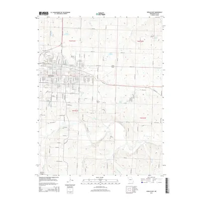
2014 Map of Sedalia East
USGS Topo · Published 2014About this map
The eastern expansion of Sedalia defines this landscape, where the urban grid meets the rural reaches of Pettis County. The city's growth is marked by its diverse community heritage, visible in the proximity of Crown Hill Cemetery and the Hebrew Cemetery near the center of the sheet. To the east, the Sedalia Regional Airport serves as a modern transportation hub, while the surrounding countryside is dotted with long-standing religious and memorial landmarks like Goodwill Chapel and Highland Sacred Garden.
Find a feature on this map
171 named features on this map. Tap any name to fly to it.
Don’t see what you’re looking for? This feature index may not catch every label — zoom into the map to look around manually.
Map Details
Editions of this 2014 Sedalia East Map
This is the sole edition of this map. No revisions or reprints were ever made.
Other maps of this area

1887 · Sedalia
USGS Topo · 1:125,000

1894 · Sedalia
USGS Topo · 1:125,000

1939 · Sweet Springs
USGS Topo · 1:62,500

1940 · Sweet Springs
USGS Topo · 1:62,500

1941 · Sweet Springs
USGS Topo · 1:62,500

1944 · Sedalia West
USGS Topo · 1:24,000

1944 · Sedalia East
USGS Topo · 1:24,000

1945 · Sweet Springs
USGS Topo · 1:62,500

1946 · Sedalia West
USGS Topo · 1:24,000

1946 · Sedalia East
USGS Topo · 1:24,000