
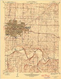
1946 Map of Sedalia East
USGS Topo · Published 1946About this map
The industrial hub of Sedalia dominates the landscape of Pettis County in the mid-1940s, shown here as a major railroad center defined by the intersection of the Missouri Pacific and M K T lines. The massive Missouri Pacific Shops and M K T Shops occupy significant territory on the western side of the city, illustrating the town's importance to the regional transit economy. The gridded streets of the city center give way to a dense network of educational institutions, including Horace Mann Sch and Eugene Field Sch, while Hebrew Cem sits near the western city limits.
Find a feature on this map
51 named features on this map. Tap any name to fly to it.
Don’t see what you’re looking for? This feature index may not catch every label — zoom into the map to look around manually.
Map Details
Editions of this 1946 Sedalia East Map
2 editions found
Other maps of this area

1887 · Sedalia
USGS Topo · 1:125,000

1894 · Sedalia
USGS Topo · 1:125,000

1939 · Sweet Springs
USGS Topo · 1:62,500

1940 · Sweet Springs
USGS Topo · 1:62,500

1941 · Sweet Springs
USGS Topo · 1:62,500

1944 · Sedalia West
USGS Topo · 1:24,000

1944 · Sedalia East
USGS Topo · 1:24,000

1945 · Sweet Springs
USGS Topo · 1:62,500

1946 · Sedalia West
USGS Topo · 1:24,000

1947 · Jefferson City
USGS Topo · 1:250,000