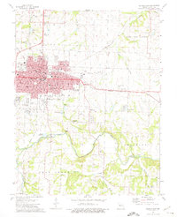
1973 Map of Sedalia East
USGS Topo · Published 1975About this map
Sedalia serves as the focal point of this mid-1970s topographic study, showing the city's eastern expansion toward Sedalia Memorial Airport. The map documents a dense concentration of civic and educational infrastructure, from the Bothwell Hosp and Smith Cotton High Sch to numerous specialized sites like the Striped College Sch. Transportation corridors are clearly defined, including the heavy rail line of the Missouri Pacific and the Missouri Kansas - Texas route.
Find a feature on this map
64 named features on this map. Tap any name to fly to it.
Don’t see what you’re looking for? This feature index may not catch every label — zoom into the map to look around manually.
Map Details
Editions of this 1973 Sedalia East Map
2 editions found
Other maps of this area

1887 · Sedalia
USGS Topo · 1:125,000

1894 · Sedalia
USGS Topo · 1:125,000

1939 · Sweet Springs
USGS Topo · 1:62,500

1940 · Sweet Springs
USGS Topo · 1:62,500

1941 · Sweet Springs
USGS Topo · 1:62,500

1944 · Sedalia West
USGS Topo · 1:24,000

1944 · Sedalia East
USGS Topo · 1:24,000

1945 · Sweet Springs
USGS Topo · 1:62,500

1946 · Sedalia West
USGS Topo · 1:24,000

1946 · Sedalia East
USGS Topo · 1:24,000