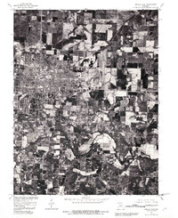
1980 Map of Sedalia East
USGS Topo · Published 1981About this map
Sedalia dominates the western half of this 1980 orthophotograph, showing its developed urban grid transitioning into the surrounding agricultural landscape of Pettis County. Produced by the Geological Survey and the Soil Conservation Service, this imagery captures the city's growth and the precise layout of its residential and industrial sectors during the early 1980s. South of the city, a winding Creek meanders through the farmland, its wooded banks providing a sharp visual contrast to the rectangular patterns of the cultivated fields and property lines. This orthophotoquad is a valuable record for researchers interested in mid-century land use and the physical expansion of this central Missouri hub before modern suburban developments altered the rural fringes.
Find a feature on this map
2 named features on this map. Tap any name to fly to it.
Don’t see what you’re looking for? This feature index may not catch every label — zoom into the map to look around manually.
Map Details
Editions of this 1980 Sedalia East Map
This is the sole edition of this map. No revisions or reprints were ever made.
Other maps of this area

1887 · Sedalia
USGS Topo · 1:125,000

1894 · Sedalia
USGS Topo · 1:125,000

1939 · Sweet Springs
USGS Topo · 1:62,500

1940 · Sweet Springs
USGS Topo · 1:62,500

1941 · Sweet Springs
USGS Topo · 1:62,500

1944 · Sedalia West
USGS Topo · 1:24,000

1944 · Sedalia East
USGS Topo · 1:24,000

1945 · Sweet Springs
USGS Topo · 1:62,500

1946 · Sedalia West
USGS Topo · 1:24,000

1946 · Sedalia East
USGS Topo · 1:24,000