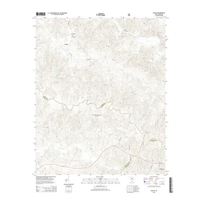
2014 Map of Sedalia
USGS Topo · Published 2014About this map
Sumter National Forest dominates the central landscape of this South Carolina quadrangle, where the Enoree River winds through the border between Union and Laurens counties. The terrain is defined by a dense network of waterways including Duncan Creek, Padgetts Cr, and the Tyger River in the northeast. Small-scale human history is visible in the scattered cemeteries such as Old Quaker Cem and New Prospects Cem, providing vital clues for genealogical research in this rural region. The small settlement of Sedalia sits north of the river, marked by the Sedalia Lookout Tower, while the northern edge of Whitmire appears in the southeast. Historical crossings like Adams Ford and Odels Ford suggest the long-standing transport patterns that preceded modern bridges. This 2014 survey captures the persistent rural character of the Piedmont, where forestry and agriculture remain the primary land uses across the overlapping boundaries of Union, Laurens, and Newberry counties.
Find a feature on this map
37 named features on this map. Tap any name to fly to it.
Don’t see what you’re looking for? This feature index may not catch every label — zoom into the map to look around manually.
Map Details
Editions of this 2014 Sedalia Map
This is the sole edition of this map. No revisions or reprints were ever made.
Other maps of this area

1941 · Spartanburg
USGS Topo · 1:250,000

1953 · Spartanburg
USGS Topo · 1:250,000

1960 · Spartanburg
USGS Topo · 1:250,000

1963 · Spartanburg
USGS Topo · 1:250,000

1964 · Spartanburg
USGS Topo · 1:250,000

1969 · Whitmire South
USGS Topo · 1:24,000

1969 · Cross Anchor
USGS Topo · 1:24,000

1969 · Newberry NW
USGS Topo · 1:24,000

1969 · Union West
USGS Topo · 1:24,000

1969 · Sedalia
USGS Topo · 1:24,000