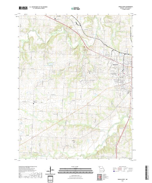
2021 Map of Sedalia West
USGS Topo · Published 2021About this map
Sedalia serves as the focal point of this Pettis County landscape, where urban expansion meets a well-ordered rural grid. The western edge of the city is defined by significant institutions like the State Fair Community College - Sedalia Campus and a network of arterial roads including W Broadway Blvd and S State Fair Blvd. Beyond the city limits, the terrain is shaped by the drainage of Flat Creek, Muddy Creek, and Camp Br, with the recreational Katy Trl cutting a diagonal path through the countryside.
Find a feature on this map
98 named features on this map. Tap any name to fly to it.
Don’t see what you’re looking for? This feature index may not catch every label — zoom into the map to look around manually.
Map Details
Editions of this 2021 Sedalia West Map
This is the sole edition of this map. No revisions or reprints were ever made.
Other maps of this area

1887 · Sedalia
USGS Topo · 1:125,000

1894 · Sedalia
USGS Topo · 1:125,000

1939 · Sweet Springs
USGS Topo · 1:62,500

1940 · Sweet Springs
USGS Topo · 1:62,500

1941 · Sweet Springs
USGS Topo · 1:62,500

1944 · Sedalia West
USGS Topo · 1:24,000

1944 · Sedalia East
USGS Topo · 1:24,000

1945 · Sweet Springs
USGS Topo · 1:62,500

1946 · Sedalia West
USGS Topo · 1:24,000

1946 · Sedalia East
USGS Topo · 1:24,000