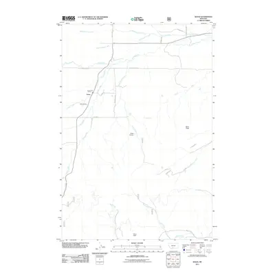
2011 Map of Sedan
USGS Topo · Published 2011About this map
The settlement of Sedan serves as the focal point for this rural Montana landscape, which is defined by its complex network of seasonal and perennial drainage. Positioned along the western edge of Battle Ridge, the community is supported by the Sedan Rural Fire Dist and anchored historically by the Sedan Cemetery. To the south, the topography rises toward Nixon Peak, where the headwaters of Nixon Creek and Brackett Creek begin their descent.
Find a feature on this map
30 named features on this map. Tap any name to fly to it.
Don’t see what you’re looking for? This feature index may not catch every label — zoom into the map to look around manually.
Map Details
Editions of this 2011 Sedan Map
This is the sole edition of this map. No revisions or reprints were ever made.
Other maps of this area

1886 · Little Belt Mts.
USGS Topo · 1:250,000

1891 · Livingston
USGS Topo · 1:250,000

1893 · Livingston
USGS Topo · 1:250,000

1894 · Little Belt Mts.
USGS Topo · 1:250,000

1897 · Little Belt Mts.
USGS Topo · 1:250,000

1898 · Little Belt Mts.
USGS Topo · 1:250,000

1902 · Little Belt Mts.
USGS Topo · 1:250,000

1947 · Bozeman
USGS Topo · 1:250,000

1948 · Bozeman
USGS Topo · 1:250,000

1948 · White Sulphur Springs
USGS Topo · 1:250,000