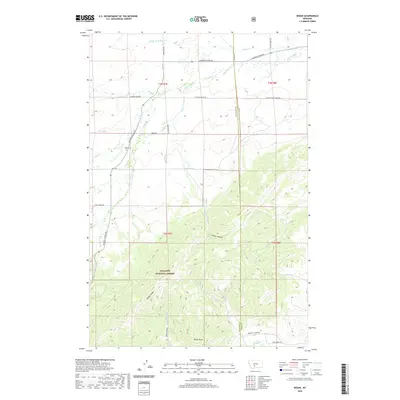
2020 Map of Sedan
USGS Topo · Published 2020About this map
Sedan Cem sits near the junction of Bridger Canyon Rd and Sedan Rd, marking a quiet historical anchor in this ranching and mountain landscape. The map reveals a transition from the lower drainage of Flathead Cr and its many tributaries, including S Fork Dry Cr and Middle Fork Dry Cr, into the high elevations of the Gallatin National Forest. To the south, the terrain rises sharply toward Battle Ridge and Nixon Peak, where the headwaters of Horse Cr and Antelope Cr begin their descent.
Find a feature on this map
36 named features on this map. Tap any name to fly to it.
Don’t see what you’re looking for? This feature index may not catch every label — zoom into the map to look around manually.
Map Details
Editions of this 2020 Sedan Map
This is the sole edition of this map. No revisions or reprints were ever made.
Other maps of this area

1886 · Little Belt Mts.
USGS Topo · 1:250,000

1891 · Livingston
USGS Topo · 1:250,000

1893 · Livingston
USGS Topo · 1:250,000

1894 · Little Belt Mts.
USGS Topo · 1:250,000

1897 · Little Belt Mts.
USGS Topo · 1:250,000

1898 · Little Belt Mts.
USGS Topo · 1:250,000

1902 · Little Belt Mts.
USGS Topo · 1:250,000

1947 · Bozeman
USGS Topo · 1:250,000

1948 · Bozeman
USGS Topo · 1:250,000

1948 · White Sulphur Springs
USGS Topo · 1:250,000