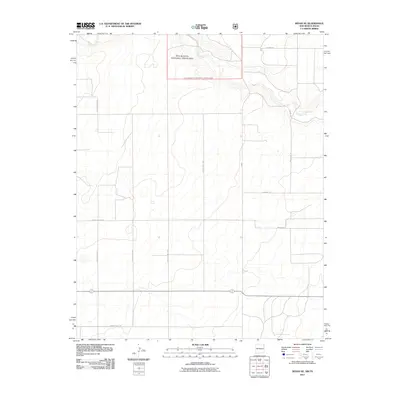
2011 Map of Sedan NE
USGS Topo · Published 2011About this map
Rita Blanca National Grassland dominates the northern landscape of this High Plains quadrangle, where the drainage of Carrizo Creek carves a subtle path through the open terrain. This portion of Union County, recorded in 2011, reflects a specialized agricultural and conservation landscape defined by a precise grid of county roads and family-named thoroughfares. Local transit and land access are facilitated by routes such as Mcclellan Rd, Dixon Ln, and Higgins Ln, which link the isolated homesteads and pastures typical of this region. The map captures the interface between managed grasslands and the network of state and local infrastructure, including Fm 296 and several numbered county highways that provide the primary connectivity for this corner of Northeast New Mexico near the Texas border.
Find a feature on this map
15 named features on this map. Tap any name to fly to it.
Don’t see what you’re looking for? This feature index may not catch every label — zoom into the map to look around manually.
Map Details
Editions of this 2011 Sedan NE Map
This is the sole edition of this map. No revisions or reprints were ever made.
Other maps of this area

1954 · Dalhart
USGS Topo · 1:250,000

1958 · Dalhart
USGS Topo · 1:250,000

1962 · Dalhart
USGS Topo · 1:250,000

1970 · Stead
USGS Topo · 1:24,000

1970 · Texline South
USGS Topo · 1:24,000

1970 · Clayton SW
USGS Topo · 1:24,000

1970 · Sedan
USGS Topo · 1:24,000

1970 · Sedan SE
USGS Topo · 1:24,000

1970 · Sedan NE
USGS Topo · 1:24,000

1973 · Corlena
USGS Topo · 1:24,000