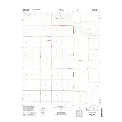
2013 Map of Sedan NE
USGS Topo · Published 2013About this map
Kiowa National Grassland occupies the northern expanse of this high-plains landscape, where the border between New Mexico and Texas is defined by a straight-line survey through the grasslands. The topography is marked by the subtle drainage of Carrizo Cr in the northeast, cutting across the state line between Union County and Dallam County. A precise grid of section lines and gravel roads governs the territory, reflecting the long-established Public Land Survey System divisions of Township 23 North, Range 36 East. This 2013 survey illustrates a sparsely populated ranching environment characterized by long-distance connectors like NM-102 and TX-102, and a series of family-named corridors such as Higgins Ln, Dixon Ln, and Woody Ln that provide access to remote agricultural holdings.
Find a feature on this map
23 named features on this map. Tap any name to fly to it.
Don’t see what you’re looking for? This feature index may not catch every label — zoom into the map to look around manually.
Map Details
Editions of this 2013 Sedan NE Map
This is the sole edition of this map. No revisions or reprints were ever made.
Other maps of this area

1954 · Dalhart
USGS Topo · 1:250,000

1958 · Dalhart
USGS Topo · 1:250,000

1962 · Dalhart
USGS Topo · 1:250,000

1970 · Stead
USGS Topo · 1:24,000

1970 · Texline South
USGS Topo · 1:24,000

1970 · Clayton SW
USGS Topo · 1:24,000

1970 · Sedan
USGS Topo · 1:24,000

1970 · Sedan SE
USGS Topo · 1:24,000

1970 · Sedan NE
USGS Topo · 1:24,000

1973 · Corlena
USGS Topo · 1:24,000