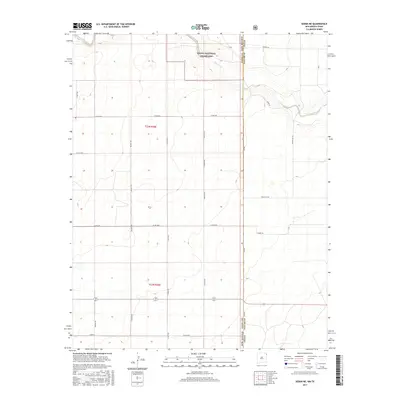
2017 Map of Sedan NE
USGS Topo · Published 2017About this map
Kiowa National Grassland dominates the northern landscape of this borderland, where the High Plains transition between New Mexico and the Texas Panhandle. The terrain is defined by the winding course of Carrizo Cr, which carves a modest valley through the township sections of t23n r36e and t22n r36e. This 2017 survey illustrates a deeply rooted ranching and agricultural grid, where a network of county and ranch roads—including Holman Rd, Newlon Rd, and McClellan Rd—connects isolated homesteads and grazing tracts. The boundary between Union County, New Mexico and Dallam County, Texas runs vertically through the eastern portion of the map, marked by FM 296 and Pipas Rd. This specific alignment reveals how modern state-line thoroughfares still follow the original land office section lines of the frontier era.
Find a feature on this map
24 named features on this map. Tap any name to fly to it.
Don’t see what you’re looking for? This feature index may not catch every label — zoom into the map to look around manually.
Map Details
Editions of this 2017 Sedan NE Map
This is the sole edition of this map. No revisions or reprints were ever made.
Other maps of this area

1954 · Dalhart
USGS Topo · 1:250,000

1958 · Dalhart
USGS Topo · 1:250,000

1962 · Dalhart
USGS Topo · 1:250,000

1970 · Stead
USGS Topo · 1:24,000

1970 · Texline South
USGS Topo · 1:24,000

1970 · Clayton SW
USGS Topo · 1:24,000

1970 · Sedan
USGS Topo · 1:24,000

1970 · Sedan SE
USGS Topo · 1:24,000

1970 · Sedan NE
USGS Topo · 1:24,000

1973 · Corlena
USGS Topo · 1:24,000