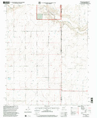
1998 Map of Sedan NE
USGS Topo · Published 2001About this map
Kiowa National Grassland dominates the northern landscape of this high plains borderland where New Mexico meets the Texas Panhandle. This high-altitude prairie is defined by its intermittent water sources and wide-open rangeland, with Carrizo Creek cutting through the northeast corner as it flows toward the state line. The map serves as a detailed record of the border interface between Union County, New Mexico, and Dallam County, Texas. While the terrain appears sparse, the numerous labeled Well locations across the township and range grid indicate the critical importance of groundwater management for the cattle ranching and agricultural operations that sustain this arid region. The boundary lines underscore the intersection of different state land management policies and county jurisdictions at the very edge of the Llano Estacado.
Find a feature on this map
5 named features on this map. Tap any name to fly to it.
Don’t see what you’re looking for? This feature index may not catch every label — zoom into the map to look around manually.
Map Details
Editions of this 1998 Sedan NE Map
This is the sole edition of this map. No revisions or reprints were ever made.
Other maps of this area

1954 · Dalhart
USGS Topo · 1:250,000

1958 · Dalhart
USGS Topo · 1:250,000

1962 · Dalhart
USGS Topo · 1:250,000

1970 · Stead
USGS Topo · 1:24,000

1970 · Texline South
USGS Topo · 1:24,000

1970 · Clayton SW
USGS Topo · 1:24,000

1970 · Sedan
USGS Topo · 1:24,000

1970 · Sedan SE
USGS Topo · 1:24,000

1970 · Sedan NE
USGS Topo · 1:24,000

1973 · Corlena
USGS Topo · 1:24,000