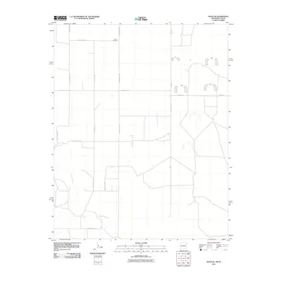
2010 Map of Sedan SE
USGS Topo · Published 2010About this map
Shaha Cemetery stands as a focal point for genealogical interest in this corner of Union County, New Mexico. The landscape is defined by the winding course of Tramperos Creek, which cuts through the southern portion of the quadrangle. This high plains area is structured by a network of rural thoroughfares, including County Hwy C-052, County Hwy C-053, and Pipas Rd, which facilitate movement across the open territory. The map illustrates a primarily ranching and agricultural region where road names like S Sedan Rd connect scattered homesteads to the broader county infrastructure. The sparse distribution of named features suggests a quiet, expansive environment where water sources and family burial grounds serve as the primary markers of human presence and history.
Find a feature on this map
13 named features on this map. Tap any name to fly to it.
Don’t see what you’re looking for? This feature index may not catch every label — zoom into the map to look around manually.
Map Details
Editions of this 2010 Sedan SE Map
This is the sole edition of this map. No revisions or reprints were ever made.
Other maps of this area

1954 · Tucumcari
USGS Topo · 1:250,000

1954 · Dalhart
USGS Topo · 1:250,000

1958 · Tucumcari
USGS Topo · 1:250,000

1958 · Dalhart
USGS Topo · 1:250,000

1962 · Dalhart
USGS Topo · 1:250,000

1970 · Stead
USGS Topo · 1:24,000

1970 · Sedan
USGS Topo · 1:24,000

1970 · Sedan SE
USGS Topo · 1:24,000

1970 · Sedan NE
USGS Topo · 1:24,000

1971 · Koger Ranch
USGS Topo · 1:24,000