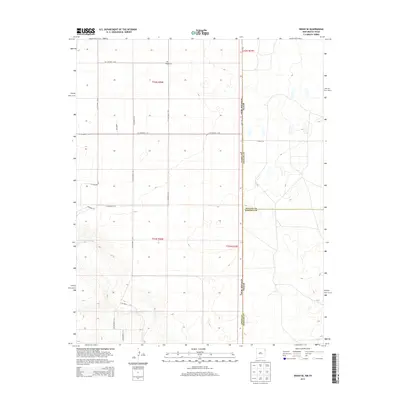
2013 Map of Sedan SE
USGS Topo · Published 2013About this map
Shaha Cem stands as a quiet landmark on the high plains of the New Mexico and Texas borderlands, located near the intersection of Co Highway C-052 and Co Highway C-053. This 2013 survey illustrates the sparsely populated ranching landscape of eastern Union County, defined by a rectilinear grid of county roads such as Liberty Rd and Co Highway C-129. The terrain is shaped by the drainage of Tramperos Cr in the south, which cuts through the otherwise level plateau. The map also delineates the precise state line where Pipas Rd runs north-south, marking the boundary between New Mexico and the Texas counties of Dallam and Hartley. This documentation provides a clear view of the section lines and township boundaries, including t22n r36e, that have governed land ownership and agricultural use in this region for generations.
Find a feature on this map
23 named features on this map. Tap any name to fly to it.
Don’t see what you’re looking for? This feature index may not catch every label — zoom into the map to look around manually.
Map Details
Editions of this 2013 Sedan SE Map
This is the sole edition of this map. No revisions or reprints were ever made.
Other maps of this area

1954 · Tucumcari
USGS Topo · 1:250,000

1954 · Dalhart
USGS Topo · 1:250,000

1958 · Tucumcari
USGS Topo · 1:250,000

1958 · Dalhart
USGS Topo · 1:250,000

1962 · Dalhart
USGS Topo · 1:250,000

1970 · Stead
USGS Topo · 1:24,000

1970 · Sedan
USGS Topo · 1:24,000

1970 · Sedan SE
USGS Topo · 1:24,000

1970 · Sedan NE
USGS Topo · 1:24,000

1971 · Koger Ranch
USGS Topo · 1:24,000