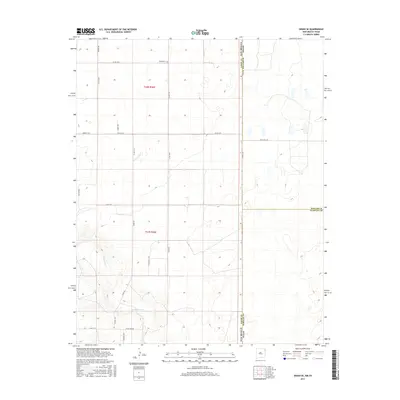
2017 Map of Sedan SE
USGS Topo · Published 2017About this map
Shaha Cem sits in the northern reaches of this high plains landscape, a solitary landmark in a region defined by an expansive grid of rural corridors. The terrain is marked by the winding course of Tramperos Cr, which cuts through the southern sections of the map, providing a natural break in the geometric precision of the township and range survey lines. This 2017 survey reflects the enduring cattle-ranching character of the borderlands between New Mexico and Texas, where the state line and several county boundaries converge near Ranch Rd 1727. Local transport is facilitated by an extensive network of named tracks, including Perkins Rd, Scott Rd, and Proffitt Rd, which serve the remote ranching operations and family holdings throughout t22n r36e and t21n r36e.
Find a feature on this map
25 named features on this map. Tap any name to fly to it.
Don’t see what you’re looking for? This feature index may not catch every label — zoom into the map to look around manually.
Map Details
Editions of this 2017 Sedan SE Map
This is the sole edition of this map. No revisions or reprints were ever made.
Other maps of this area

1954 · Tucumcari
USGS Topo · 1:250,000

1954 · Dalhart
USGS Topo · 1:250,000

1958 · Tucumcari
USGS Topo · 1:250,000

1958 · Dalhart
USGS Topo · 1:250,000

1962 · Dalhart
USGS Topo · 1:250,000

1970 · Stead
USGS Topo · 1:24,000

1970 · Sedan
USGS Topo · 1:24,000

1970 · Sedan SE
USGS Topo · 1:24,000

1970 · Sedan NE
USGS Topo · 1:24,000

1971 · Koger Ranch
USGS Topo · 1:24,000