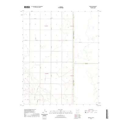
2020 Map of Sedan SE
USGS Topo · Published 2020About this map
Shaha Cem sits in the northern reaches of this high plains landscape, a primary marker for genealogists in a region defined by large-scale ranching and agriculture. The landscape is bisected by the New Mexico-Texas state line, where Union County meets Dallam and Hartley counties. Water is a defining scarce resource here, centered on the drainage of Tramperos Cr as it winds through the southwestern sections. The map reveals a rigid section-line road network, where family-named routes like Proffitt Rd, Speed Rd, and Speer Rd suggest the early settlement history of this borderland. The transition from New Mexico into Texas is marked by shifts in road designations, such as Ranch Rd 1727, reflecting the different administrative approaches to this shared grazing territory.
Find a feature on this map
24 named features on this map. Tap any name to fly to it.
Don’t see what you’re looking for? This feature index may not catch every label — zoom into the map to look around manually.
Map Details
Editions of this 2020 Sedan SE Map
This is the sole edition of this map. No revisions or reprints were ever made.
Other maps of this area

1954 · Tucumcari
USGS Topo · 1:250,000

1954 · Dalhart
USGS Topo · 1:250,000

1958 · Tucumcari
USGS Topo · 1:250,000

1958 · Dalhart
USGS Topo · 1:250,000

1962 · Dalhart
USGS Topo · 1:250,000

1970 · Stead
USGS Topo · 1:24,000

1970 · Sedan
USGS Topo · 1:24,000

1970 · Sedan SE
USGS Topo · 1:24,000

1970 · Sedan NE
USGS Topo · 1:24,000

1971 · Koger Ranch
USGS Topo · 1:24,000