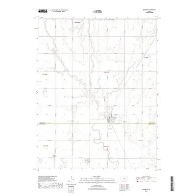
2018 Map of Sedgwick
USGS Topo · Published 2018About this map
The Little Arkansas River meanders across the boundary of Harvey and Sedgwick Counties, anchoring a rural landscape defined by precision agricultural surveying and small-town centers. Newton occupies the northern edge of the sheet, while the city of Sedgwick sits further south near the river's bend. The map documents the persistent layout of section-line roads like S Mission Rd and S West Rd that organize the Kansas plains into a geometric grid. Smaller community points like Van Arsdale and Putnam remain visible alongside several watercourses including Emma Cr and Sand Cr. For family historians, local landmarks such as Hillside Cem and Pleasant Valley Cem provide specific points of interest for genealogical research, while the presence of Sooter Airport reflects the region's aviation infrastructure.
Find a feature on this map
58 named features on this map. Tap any name to fly to it.
Don’t see what you’re looking for? This feature index may not catch every label — zoom into the map to look around manually.
Map Details
Editions of this 2018 Sedgwick Map
This is the sole edition of this map. No revisions or reprints were ever made.
Other maps of this area

1889 · Newton
USGS Topo · 1:125,000

1889 · Cheney
USGS Topo · 1:125,000

1889 · Wichita
USGS Topo · 1:125,000

1891 · Hutchinson
USGS Topo · 1:125,000

1891 · Cheney
USGS Topo · 1:125,000

1893 · Hutchinson
USGS Topo · 1:125,000

1894 · Wichita
USGS Topo · 1:125,000

1894 · Newton
USGS Topo · 1:125,000

1901 · Cheney
USGS Topo · 1:125,000

1941 · Maize
USGS Topo · 1:31,680