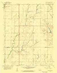
1959 Map of Sedgwick NE
USGS Topo · Published 1960About this map
Agricultural lands across the border of Harvey and Sedgwick counties define this late 1950s landscape, where rural life revolves around established schools and the energy industry. The townships of Darlington, Richland, and Grant are marked by a grid of section roads and small local institutions, including Dewey Sch, Norris Sch, and Centennial Sch. Near the southern boundary, the Goodrich Oil Field and Kuske Oil Field reveal the importance of petroleum extraction to the local economy alongside traditional farming.
Find a feature on this map
22 named features on this map. Tap any name to fly to it.
Don’t see what you’re looking for? This feature index may not catch every label — zoom into the map to look around manually.
Map Details
Editions of this 1959 Sedgwick NE Map
2 editions found
Other maps of this area

1889 · Newton
USGS Topo · 1:125,000

1889 · Wichita
USGS Topo · 1:125,000

1894 · Wichita
USGS Topo · 1:125,000

1894 · Newton
USGS Topo · 1:125,000

1941 · Maize
USGS Topo · 1:31,680

1941 · Valley Center
USGS Topo · 1:31,680

1942 · Valley Center
USGS Topo · 1:31,680

1942 · Maize
USGS Topo · 1:31,680

1955 · Greenwich
USGS Topo · 1:24,000

1955 · Wichita
USGS Topo · 1:250,000