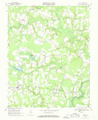
1968 Map of Sedley
USGS Topo · Published 1970About this map
Sedley serves as a primary hub in this late-1960s landscape, positioned along the Norfolk and Western railroad line. The geography is defined by a dense network of slow-moving water and wetlands, including Brantley Swamp, Cypress Swamp, and Cattail Swamp, which converge toward the Blackwater River along the Southampton and Isle of Wight county line. The presence of numerous millponds, such as Whitefields Millpond and Johnson Millpond, indicates a long-standing reliance on local waterways for industry and power.
Find a feature on this map
32 named features on this map. Tap any name to fly to it.
Don’t see what you’re looking for? This feature index may not catch every label — zoom into the map to look around manually.
Map Details
Editions of this 1968 Sedley Map
2 editions found
Other maps of this area

1919 · Homeville
USGS Topo · 1:48,000

1919 · Boykins
USGS Topo · 1:48,000

1920 · Holland
USGS Topo · 1:62,500

1920 · Ivor
USGS Topo · 1:62,500

1920 · Homeville
USGS Topo · 1:62,500

1920 · Boykins
USGS Topo · 1:62,500

1943 · Holland
USGS Topo · 1:62,500

1943 · Manry
USGS Topo · 1:31,680

1943 · Vicksville
USGS Topo · 1:31,680

1944 · Ivor
USGS Topo · 1:24,000