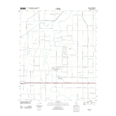
2012 Map of Seeley
USGS Topo · Published 2012About this map
The settlement of Seeley sits at the heart of an intricate irrigation network in the Imperial Valley, where the engineered landscape meets the winding path of the New River. This 2012 survey illustrates the high density of water management infrastructure required for desert agriculture, dominated by the Westside Main Canal, Elder Canal, and Fern Canal. To the north and west of the town center, the terrain is partitioned by a grid of named lateral drains and canals, including the Salt Cr Slough and Bullhead Slough, which weave through the agricultural blocks.
Find a feature on this map
143 named features on this map. Tap any name to fly to it.
Don’t see what you’re looking for? This feature index may not catch every label — zoom into the map to look around manually.
Map Details
Editions of this 2012 Seeley Map
This is the sole edition of this map. No revisions or reprints were ever made.
Other maps of this area

1915 · El Centro
USGS Topo · 1:125,000

1940 · Brawley
USGS Topo · 1:62,500

1940 · Heber
USGS Topo · 1:62,500

1940 · Plaster City
USGS Topo · 1:62,500

1940 · Coyote Wells
USGS Topo · 1:62,500

1942 · El Centro
USGS Topo · 1:250,000

1943 · Coyote Wells
USGS Topo · 1:62,500

1943 · Heber
USGS Topo · 1:62,500

1943 · Brawley
USGS Topo · 1:62,500

1944 · Plaster City
USGS Topo · 1:62,500