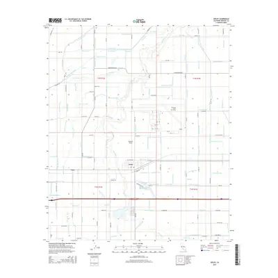
2015 Map of Seeley
USGS Topo · Published 2015About this map
The Imperial Valley landscape is defined by an intricate network of irrigation and drainage infrastructure surrounding the settlements of Seeley and Edgar. This complex system of water management, vital for agriculture in this desert region, is represented by numerous named features such as the Westside Main Canal, Fillaree Canal, and Forget-Me-Not Canal. The New River winds through the center of the terrain, while the extensive El Centro Naval Air Facility occupies a significant portion of the eastern landscape, complete with its runways and support buildings. The map provides a look at the precise layout of local roads like Huff Rd and Silsbee Rd, alongside more idiosyncratic features like the Wormwood Drain and Salt Cr Slough. This detailed spatial record of the California borderlands reflects the region's total reliance on water engineering to sustain both military operations and local communities.
Find a feature on this map
138 named features on this map. Tap any name to fly to it.
Don’t see what you’re looking for? This feature index may not catch every label — zoom into the map to look around manually.
Map Details
Editions of this 2015 Seeley Map
This is the sole edition of this map. No revisions or reprints were ever made.
Other maps of this area

1915 · El Centro
USGS Topo · 1:125,000

1940 · Brawley
USGS Topo · 1:62,500

1940 · Heber
USGS Topo · 1:62,500

1940 · Plaster City
USGS Topo · 1:62,500

1940 · Coyote Wells
USGS Topo · 1:62,500

1942 · El Centro
USGS Topo · 1:250,000

1943 · Coyote Wells
USGS Topo · 1:62,500

1943 · Heber
USGS Topo · 1:62,500

1943 · Brawley
USGS Topo · 1:62,500

1944 · Plaster City
USGS Topo · 1:62,500