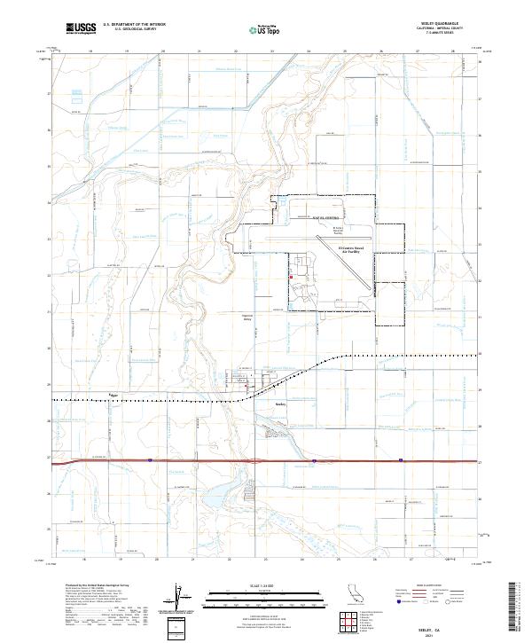
2021 Map of Seeley
USGS Topo · Published 2021About this map
Imperial Valley agriculture and military infrastructure define this landscape west of El Centro. The New River meanders through the center of the sheet, flanked by a dense grid of irrigation features including the Westside Main Canal, Fillaree Canal, and Flax Canal. These engineered waterways support the extensive desert farming operations characteristic of the region. Centered on the map is the town of Seeley, established along the San Diego and Arizona Eastern Railway corridor, shown here with its local street grid including El Centro St and Alamo St. To the northeast, the El Centro Naval Air Facility occupies a significant portion of the desert floor, with its runways and support buildings clearly delineated. Smaller agricultural points of interest like the settlement of Edgar and numerous named drains—such as Dixie Drain One and Rice Drain Six—illustrate the complex water management system required to sustain life and industry in this arid environment.
Find a feature on this map
170 named features on this map. Tap any name to fly to it.
Don’t see what you’re looking for? This feature index may not catch every label — zoom into the map to look around manually.
Map Details
Editions of this 2021 Seeley Map
This is the sole edition of this map. No revisions or reprints were ever made.
Other maps of this area

1915 · El Centro
USGS Topo · 1:125,000

1940 · Brawley
USGS Topo · 1:62,500

1940 · Heber
USGS Topo · 1:62,500

1940 · Plaster City
USGS Topo · 1:62,500

1940 · Coyote Wells
USGS Topo · 1:62,500

1942 · El Centro
USGS Topo · 1:250,000

1943 · Coyote Wells
USGS Topo · 1:62,500

1943 · Heber
USGS Topo · 1:62,500

1943 · Brawley
USGS Topo · 1:62,500

1944 · Plaster City
USGS Topo · 1:62,500