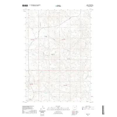
2021 Map of Seely
USGS Topo · Published 2021About this map
Squaw Buttes and the winding course of the Belle Fourche River define this corner of Crook County, where the high plains break into a complex system of drainages and named canyons. The landscape is marked by evocative landforms such as Lovers Leap and Bay Mtn, separated by deep cuts like Government Canyon and Steam Engine Canyon. This terrain dictated the placement of early routes like Government Canyon Rd and the Deer Creek Rd, which follow the natural contours of the land. Water remains the primary geographical anchor here, with numerous seasonal and perennial flows including Sourdough Cr, Buck Cr, and Bronco John Cr carving through the township and range sections. The map reveals how local infrastructure, including Co RD 23 and N Alzada Rd, connects these isolated geographical features across the northern Wyoming landscape.
Find a feature on this map
25 named features on this map. Tap any name to fly to it.
Don’t see what you’re looking for? This feature index may not catch every label — zoom into the map to look around manually.
Map Details
Editions of this 2021 Seely Map
This is the sole edition of this map. No revisions or reprints were ever made.
Other maps of this area

1901 · Aladdin
USGS Topo · 1:125,000

1903 · Aladdin
USGS Topo · 1:125,000

1905 · Devils Tower
USGS Topo · 1:125,000

1954 · Strawberry Hill
USGS Topo · 1:24,000

1954 · Storm Hill
USGS Topo · 1:24,000

1954 · Gillette
USGS Topo · 1:250,000

1955 · Devils Tower
USGS Topo · 1:62,500

1955 · Gillette
USGS Topo · 1:250,000

1957 · Mona
USGS Topo · 1:62,500

1957 · Seely
USGS Topo · 1:62,500