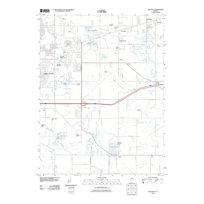
2010 Map of Seelyville
USGS Topo · Published 2010About this map
Terre Haute and its eastern suburbs are captured during a period of modern expansion, where residential subdivisions and infrastructure meet the established industrial and agricultural roots of Vigo County. The landscape is dotted with evidence of early settlement, most notably in the high density of burial grounds like Highland Lawn Cemetery and Calvary Cemetery, alongside smaller family plots such as Rogers Cemetery and Mewhinney Cemetery. The extraction history of the region is anchored by the Mount Pleasant Mine, while the importance of local water management is visible through a complex network of dams and small reservoirs, including Patton Lake and Maple Avenue Lake. Communities like Seelyville, Tabertown, and Riley serve as anchors for the surrounding rural area, which is increasingly defined by the presence of Hulman Field and the recreational grounds of Deming Park.
Find a feature on this map
62 named features on this map. Tap any name to fly to it.
Don’t see what you’re looking for? This feature index may not catch every label — zoom into the map to look around manually.
Map Details
Editions of this 2010 Seelyville Map
This is the sole edition of this map. No revisions or reprints were ever made.
Other maps of this area

1908 · Clay City
USGS Topo · 1:48,000

1910 · Clay City
USGS Topo · 1:62,500

1940 · Lewis
USGS Topo · 1:24,000

1940 · Pimento
USGS Topo · 1:24,000

1941 · Seelyville
USGS Topo · 1:24,000

1941 · Terre Haute
USGS Topo · 1:24,000

1948 · Terre Haute
USGS Topo · 1:24,000

1950 · Rosedale
USGS Topo · 1:24,000

1950 · Brazil West
USGS Topo · 1:24,000

1950 · New Goshen
USGS Topo · 1:24,000