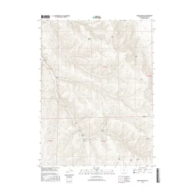
2016 Map of Segar Mountain
USGS Topo · Published 2016About this map
Segar Mountain and Joe Bush Mtn dominate this portion of the Piceance Basin, where a complex network of canyons and gulches defines the drainage patterns of Rio Blanco County. The landscape is marked by essential water sources like Post Gulch Spring and Timber Gulch Spring Number 1, which supported cattle ranching and homesteading in this arid environment. Significant drainage ways such as Dry Fork Piceance Creek and Joe Bush Gulch cut through the high-elevation terrain, illustrating the natural watercourses that dictate movement through the region. Small-scale water management is visible at Pitcairn Reservoir, while the presence of Co RD 22 provides the primary transit route through this remote section of the Colorado Plateau.
Find a feature on this map
29 named features on this map. Tap any name to fly to it.
Don’t see what you’re looking for? This feature index may not catch every label — zoom into the map to look around manually.
Map Details
Editions of this 2016 Segar Mountain Map
This is the sole edition of this map. No revisions or reprints were ever made.
Other maps of this area

1906 · Grand Hogback
USGS Topo · 1:125,000

1907 · White River
USGS Topo · 1:125,000

1910 · Danforth Hills
USGS Topo · 1:125,000

1910 · Grand Hogback
USGS Topo · 1:125,000

1910 · White River
USGS Topo · 1:125,000

1912 · Meeker
USGS Topo · 1:62,500

1914 · Meeker
USGS Topo · 1:62,500

1952 · Jessup Gulch
USGS Topo · 1:24,000

1952 · Greasewood Gulch
USGS Topo · 1:24,000

1952 · No Name Ridge
USGS Topo · 1:24,000