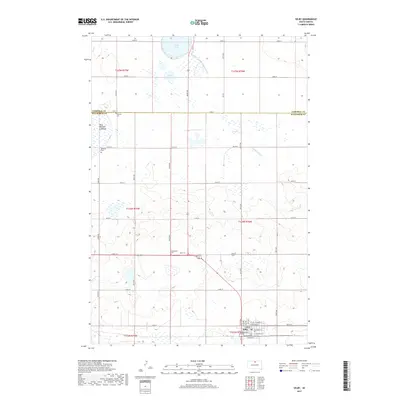
2017 Map of Selby
USGS Topo · Published 2017About this map
Selby serves as the primary hub of this north-central South Dakota landscape, situated at the junction of local thoroughfares and the railway line. The town's grid is detailed with street names like Theodore St and Bangor St, while the surrounding prairie is defined by a rigorous township and range system. This survey captures a terrain transitioning between agricultural use and seasonal water bodies, including the wide Blue Blanket Lakebed and the courses of Hiddenwood Creek. Local heritage is anchored by sites such as Bethany Cemetery and Bethlehem Cemetery, which sit along the gravel section lines that divide the high plains. The presence of Sand Lake and Little Sand Lake in the north suggests the importance of water management in this part of Walworth County, where the topography is shaped by subtle drainage patterns and historical land divisions.
Find a feature on this map
29 named features on this map. Tap any name to fly to it.
Don’t see what you’re looking for? This feature index may not catch every label — zoom into the map to look around manually.
Map Details
Editions of this 2017 Selby Map
This is the sole edition of this map. No revisions or reprints were ever made.
Other maps of this area

1953 · McIntosh
USGS Topo · 1:250,000

1954 · Aberdeen
USGS Topo · 1:250,000

1956 · Aberdeen
USGS Topo · 1:250,000

1958 · McIntosh
USGS Topo · 1:250,000

1967 · Mound City
USGS Topo · 1:24,000

1967 · Selby SW
USGS Topo · 1:24,000

1967 · Selby
USGS Topo · 1:24,000

1967 · Selby NW
USGS Topo · 1:24,000

1968 · Akaska NW
USGS Topo · 1:24,000

1968 · Akaska NE
USGS Topo · 1:24,000