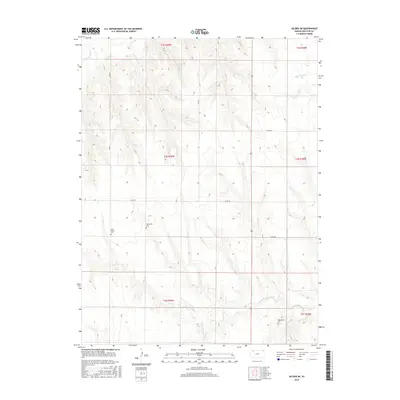
2015 Map of Selden NE
USGS Topo · Published 2015About this map
High plains creek valleys define this portion of Decatur County, where the S Fork Sappa Cr and Prairie Dog Cr carve drainage patterns across the Kansas landscape. The area is characterized by a sparse grid of rural roads, including Co RD 352 and 950 RD, connecting scattered sites of local heritage. This 2015 survey reveals a history of religious and community life through the presence of the Lund Church and its adjacent Lund Church Cem. The distribution of burial sites, such as the Mennonite Cem and the Shibboleth Cem in the southeastern corner, provides a window into the settlement patterns and genealogy of the early farming families who managed these townships. Water remains a central feature, with Big Timber Cr and the N Fork Prairie Dog Cr winding through the terrain, indicating the vital importance of natural drainages to the local agricultural economy.
Find a feature on this map
21 named features on this map. Tap any name to fly to it.
Don’t see what you’re looking for? This feature index may not catch every label — zoom into the map to look around manually.
Map Details
Editions of this 2015 Selden NE Map
This is the sole edition of this map. No revisions or reprints were ever made.
Other maps of this area

1951 · Selden
USGS Topo · 1:62,500

1951 · Oberlin
USGS Topo · 1:62,500

1951 · Kanona
USGS Topo · 1:62,500

1954 · Goodland
USGS Topo · 1:250,000

1956 · Goodland
USGS Topo · 1:250,000

1957 · Goodland
USGS Topo · 1:250,000

1965 · Oberlin
USGS Topo · 1:24,000

1965 · Kanona
USGS Topo · 1:24,000

1965 · Oberlin SW
USGS Topo · 1:24,000

1965 · Selden NW
USGS Topo · 1:24,000